BBC: "Historic England releases map based on 500,000 aerial pictures"
The landscape today may look like featureless arable fields but when photographed from the air in hot, dry summers patterns begin to emerge.

Source: BBC: Historic England releases map based on 500,000 aerial pictures
This is, after all, “The Anglophilic Anglican,” and that Anglophilia extends to far more than just ecclesiastical, or even Royal, affairs! The secular history, and prehistory, of the British Isles is also – and has long been – fascinating to me!
According to the linked article,
“More than half a million aerial images of historical sites in England have been used for a new mapping tool. Photographs and 3D laser scans have been taken over the past 30 years to uncover hidden archaeological landscapes,” including “6,000-year-old long barrows, Roman camps such as those on Hadrian's Wall and 20th Century areas linked to the world wars.”
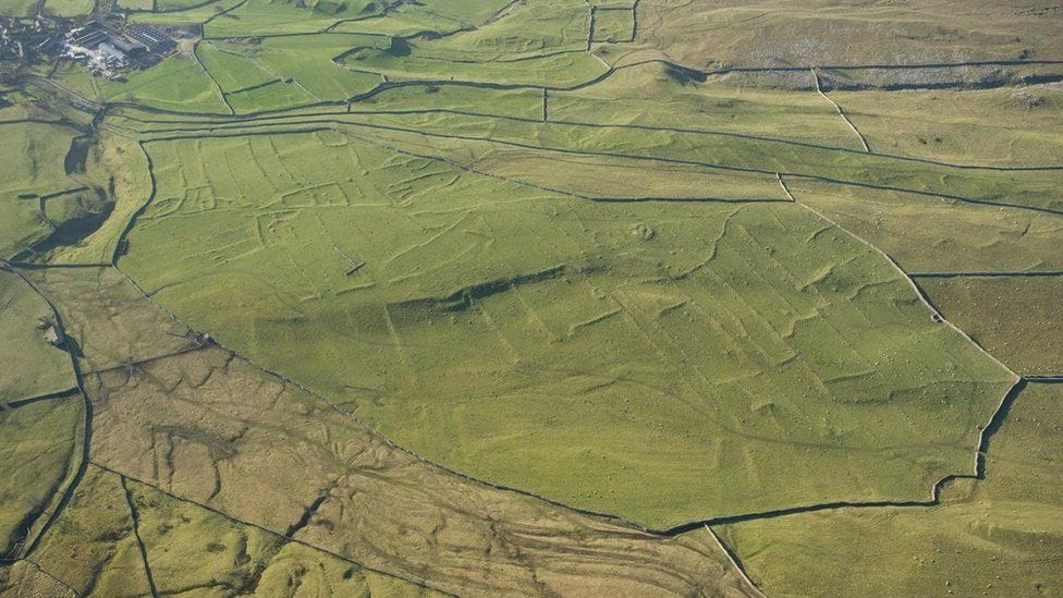
The post reports that Historic England has highlighted eight examples of “hidden history” unearthed by aerial mapping. One of these is at Grassington (image above), in the Yorkshire Dales, a market town and civil parish in the Craven district of North Yorkshire, England:
“The images show lumps and bumps on the ground which represent the remains of settlements dating back to the prehistoric period, with a ‘spectacular’ example at Grassington where long shadows in winter months pick out the earthworks of fields and enclosures, a spokesman said.”
Aerial photography, taken during dry seasons when moisture (and thus, darker-green vegetation) lingers in ancient depressions carved out of the land by human effort, or during early morning or late afternoon, when low sun angles cause such features as earthworks, ditches, the remnants of walls and hedgerows, etc., to pop out in sharp relief, is of course not a new technique in seeking evidence of ancient settlement.
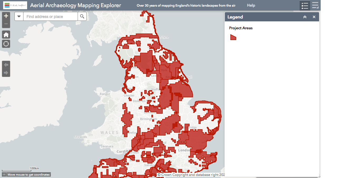
But combining such a vast database of images, and linking them to an interactive map – which covers half the country – carries this technique to a whole different level, making it usable by ordinary people who are interested in the past of their own or other areas. Duncan Wilson, chief executive of Historic England, comments:
“This new aerial archaeology mapping tool lets people fly virtually over England and drink in its many layers of history. We hope it will give people a springboard to further investigation, whether for research purposes or simply to satisfy curiosity about what archaeological features they may have noticed around their local area.”
As to the The Aerial Archaeology Mapping Explorer itself, its website states that is a tool displaying archaeology that has been identified, mapped and recorded using aerial photographs and other aerial sources across England.
“For the first time ever, Historic England has made the results of over 30 years of aerial photograph mapping projects freely available online. Use it to explore heritage from ancient settlements to secret Cold War military installations, or to see the complex archaeological landscapes of Hadrian’s Wall, Stonehenge and so much in between…
“The Aerial Archaeology Mapping Explorer lets you explore the layers of archaeology in and around your local place. You can browse the map and zoom in to the location you’re interested in or search by postcode, address or place name.”
Most interesting!


